



FEDERAL GOVERNMENT
ES2 is an SBA 8(a) company with decades of federal support as a Prime Contractor in delivering a variety of services, including project management, multidisciplinary services, and accurate field data collection from the Air, Land, and Sea to support civil works and military federal missions. ES2’s mission is to perform high-quality work on time and within budget, with minimal risk to the client, on all projects.



OUR SERVICES


Surveying & Data Collection
We capture ground-truthed Surveying, UAS, LiDAR, Indoor, and Hydrographic data to power government missions and provide leadership with a reliable foundation for every subsequent decision. ES2 has specialized Federal experience collecting data for a variety of large- and small-scale projects such as master planning, engineering support, construction support, natural resource support, cultural resource support, structural assessments, H&H support, inspection/monitoring, quality assurance, and sedimentation.


Engineering
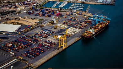
After we collect your data, our engineering team can process and analyze the data to develop multiple engineering deliverables such as volume calculations, elevation models, 3D visualizations, floodplain visualization, bathymetry visualization, environment compassions, inspection comparisons, and technical document development. All deliverables can be visualized in a GIS environment for use by all stakeholders. Our engineering team is also very experienced in providing project management, construction management, and scheduling support on multiple Federal civil works projects.

Environmental
ES2 has a wide range of environmental technical talent. Our environmental team is built on the combined experience of our key personnel, including NEPA specialists, HTRW specialists, biologists, foresters, anthropologists, urban planners, economists, and environmental managers. Our environmental team has direct Federal experience providing NEPA Compliance: interagency coordination, Phase 1 & 2 ESAs, interpretive planning, cultural resources studies, environmental infrastructure analysis, operational management plans, economic forecasts, and dredge sediment sampling.

Natural Resource Services
ES2 has always focused on the leading-edge technologies in remote sensing to support its environmental projects. Our combination of technology and natural resource experts allows us to provide high-quality deliverables, including additional GIS data layers for future use. We support projects in natural resource management, endangered species and habitat mapping, invasive species management, tree inventories, environmental monitoring, beach vegetation and wildlife surveys, habitat classification, coastal land loss assessment, mitigation bank monitoring, project master plans, and Integrated Natural Resources Management Plans (INRMPs).
Emergency Management
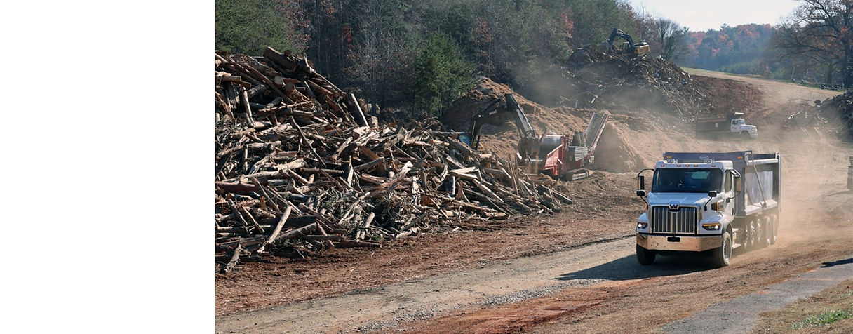
ES2 has a track record of mobilizing subject matter experts and geospatial personnel to conduct baseline pre-incident assessments, post-event debris estimation, debris eligibility determinations, debris team training, drone-based damage assessment, and end-to-end GIS support for rapid, informed disaster response across your jurisdiction when every minute matters. Our staff has responded to hurricanes, floods, tornadoes, waterways, and wildfires in disaster response missions, providing services ranging from technical assistance to damage assessment. Our personnel understand all aspects of emergency management teams, including documentation, regulations, construction, and stakeholder coordination and management.
NAICS Codes
Primary - 541370
Surveying and Mapping (except Geophysical) Services
541620
Environmental Consulting
Services
541330
Engineering
Services
541690
Other Scientific and Technical Consulting Services
541990
All Other Professional, Scientific, and Technical


ES2 CLIENTS


READY TO TALK ABOUT YOUR NEEDS?
Whether you're a federal contracting officer, state & local agency, or port authority leader, or an AEC firm evaluating teaming options, we're ready to discuss your scope and how ES2 can support your program.