


MARITIME PORTS
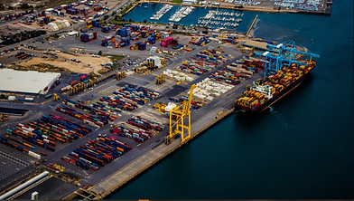
Modern port operations depend on reliable asset intelligence and connected systems.
We integrate GIS with your existing business systems, including real estate, asset management, AIS, real-time vessel management, and port community systems, creating the operational visibility needed to strengthen resilience, support growth, and advance your Digital Twin journey.
30+
Years of Experience
6+
State Licenses
Licensed
Pilots, Engineers, Surveyors
GOLD
Esri Partner
Recent
OUR SERVICES



Data Development & Collection
Migrating legacy data into modern GIS features to support business needs. When needed, we will capture ground-truthed Surveying, UAS, LiDAR, and Hydrographic data to power accurate GIS applications and provide port leadership with a reliable foundation for every decision that follows.



Real-Time GIS
Situational visibility supports faster, more informed decisions. We implement real-time GIS solutions that connect operational data across emergency management, weather response, tariff reporting, and just-in-time vessel awareness, helping your team respond confidently as conditions change.


ES2 CLIENTS


READY TO TALK ABOUT YOUR NEEDS?
Whether you're a federal contracting officer, state & local agency, or port authority leader, or an AEC firm evaluating teaming options, we're ready to discuss your scope and how ES2 can support your program.